The Sierra Nevada – the most beautiful hikes in the highest mountain range of Spain
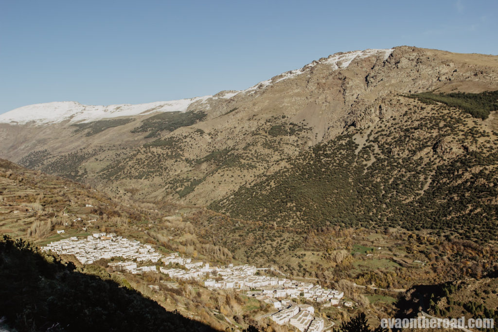
Surprisingly, the Sierra Nevada massif rises in hot Andalusia, not far from the famous city of Granada and barely an hour’s drive from the crowded Costa del Sol coast. With its peaks exceeding 3,000 m, the Sierra Nevada is a popular destination for climbers, hikers and skiers in winter. White villages at the altitude of 1,500 m wedged between mountain peaks are completely different from the murmur of beaches and coastal towns. They are a world of peace, silence, greenery and also of the best Spanish ham. The mountains are crossed by many hiking trails, so it´s up to you, how much time and condition you have for them. I have chosen two trails that will definitely not disappoint you.
Obsah článku
The easiest access to the Sierra Nevada is from the north, Granada, which is only 40 km away. But we chose an approach from the south, from the Alpujarras region. It will extend your journey by 30 km, but driving along a road pinned to rocky massifs and through mountain villages, whose white houses sharply contrast with the dark peaks of the mountains, is an unforgettable experience that you should not miss. As a starting point of our hikes, we chose the village of Capileira located at an altitude of 1,440 m in the shade of Pico de Veleta.
From Capileira to Trevélez – a hike with breath-taking views in a paradise of ham
One of the nicest hikes you can take in the Sierra Nevada leads to the highest placed village, yet it is not very difficult. We get out around 9 a.m. and make a mistake at the very beginning: we go in a wrong direction. Instead of up we illogically take quick steps downhill towards the village of Bubión. After more than one kilometre we find out our mistake, turn around and step back. After 40 minutes we are back in the same place J Otherwise, you don´t need to worry, the road is marked very well with red-white marks and GR240 marking.
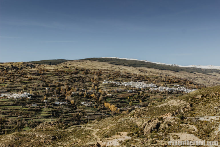
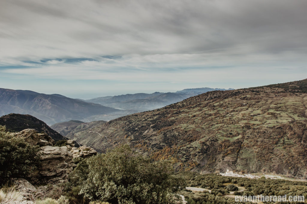
The start of the hike is not easy, because the first 6 km you will only climb up, but the terrain is not difficult. From Capileira, the first kilometre is slightly uphill along the road until the viewpoint of Tajos del Ángel. Below us, there are two white villages, Bubión and Capileira, and around them massifs of mountains are expanding. That is the first as well as the last spectacular view for a long time. Then we climb steeply up through a pine forest. We pass a large water reservoir (apparently a drinking water reservoir, because the entire reservoir is fenced), where we can see for a while the surrounding mountains and valleys, then we disappear again in forest until about an hour and a half later, we climb to a picnic spot Hoya del Portillo. There is a large parking lot, so you can get there by car from Capileira. But this is unsuitable for our hike, because you will not come back to this place any more. Hoya del Portillo may be the starting point for your next hike to the Refugio Poqueira, which I will discuss below. We continue to adhere to the red-white markings, the forest begins to thin and soon, beautiful views open. We reach the highest point of our journey today (2,250 m), we are already partially on the snow, there is peace and quiet of the mountains around us, birds are carried away by the wind, and at a distance, the Mediterranean Sea glitters. Even though it is almost the end of November, the sun is shining and we are wearing a T-shirt. Shortly, an idyll. We have been on our hike for about four hours and so far we have met only 4 people who went for a walk near the parking lot. We take a break on a plateau, take pictures and send our drone high up towards birds. The second half of the hike is more comfortable, mostly we go flat or slightly down the hill through plateaus and mountain meadows, we enjoy beautiful views, cross streams, watch herds of chamois and lazily lying cows. About 4 km in front of Trevélez, we will swing over a hill overlooking the next valley and we will have quite a steep descent. We regret some tourists who are stepping up against us with full packs. Suddenly, deeply beneath us we see a graveyard and white facades of houses in Trevélez. We only have 2 km to the end, but the depth below us is still quite large, we have to descent 300 meters more. At the end we cross the Rio Chico river (fortunately there is not so much water), then the last steep ascent to a small hill and quickly to the village. We do not have much time to see this highest placed Spanish village (1,500 m), because we take a bus back to Capileira. After the hike, we have a well-deserved glass of Rioja in a local tapas bar and will return to the village the next day by car, because Trevélez is famous for making jamón serrano ham. A factory, a drying room, or at least a shop can be found here in almost every large house. If you are faster during your hike, you can make a tour of the factory in the same day. It will take you less than an hour even with tasting. Just watch the time, the last bus runs at 5.30.
Tour information: Length 19 km, 6-7 hours, it was passable in November. The first half of the hike is only going uphill, but you can make it, it is mostly led along a wide path. The other half of the hike offers incredible views. There is a bus from Trevélez to Capileira. You can make one at 4 pm or the last one at 5:30 pm. Check the times on the carrier’s website. The ticket costs EUR 1.87, the bus journey takes 45 minutes and you can enjoy great views while sitting on the bus. The hike is marked very well with red-white marks all along the path, you cannot get lost
From Capileira to Refugio Poquier – or how we didn’t reach our destination
Another popular trek leads to a mountain cottage called Refugio Poquiera at an altitude of 2,500 m, which is open all year round and you can sleep there (12 EUR). From the cottage you can continue to Mulhacén (3,360 m), the highest peak of Sierra Nevada. There are two options how to get there from Capileira – via Hoya del Portillo (you can get there comfortably by car – see previous hike) or through La Cebadilla Power Station. We chose the second option. You can accelerate the first three kilometres and drive to La Cebadilla by car. There is no tarmac, but only paved road with several holes, so you have to drive carefully, but it´s possible to drive there (if there is snow, check it in advance).
Unfortunately, the weather is not in favour of us, there is a very strong wind from early morning, furniture flies around on the terrace of our house and wind is breaking through the windows. We do not want to go anywhere, but in the end at 11 am we decide and go. From the village we are walking, we will not shorten our journey by car, as we have a rented Punto and it might be carried away by the wind. According to our landlady, it might take us 3 hours to get up to cottage. But that overestimated us a lot. From Capileira we have a steep climb in front of us, which in combination with the wind is not an ideal start, and after a few tens of meters we think we better turn around. At times it is not even possible to go further because of the wind. But we meet two girls who had the same crazy idea as us, which encourages us a bit, so we continue. The road will soon straighten and we will manage the first three kilometres in less than an hour. We reach an abandoned village of La Cebadilla. At its end there is a functional hydroelectric power station. At the power station we cross a bridge and continue to the right with a sharp ascent. Climbing up will stay for almost the whole journey. The path is wide rocky for a while, then it narrows, it leads through pastures with two farms, but we do not meet anyone but one shepherd. We ascend to 1,700 m to a place called Cortijo del Naute, and then slowly descend to the Rio Naute River. We cross the first bridge and continue along the right bank of the river for a while, after a few hundred meters we have to cross a pretty wide stream leading to Río Naute. But there is no bridge and the stream is quite full of water, so my boyfriend has to bring some stones for us to cross, and we cross with almost dry foot. In pastures around, there are cows with nice horns which don´t look very friendly, one even runs towards us, so I got quite chased, but eventually they let us go. In a short while we are returning across another bridge to the left bank of the Naute River. We are now at an altitude of 1,800 m, the wind is still blowing a lot and the hike is getting quite strenuous. We have to cross two more rivers – Rio Veleta and Rio Mulhacén. Below us, the gorge of Barranco Peñon Grande and Peñon Gordo lie, above us almost three thousand metres high peaks rise. At this point, the worst part of the hike begins. According to the navigation, we have two kilometres to go, but we still have to climb a 600 m elevation. It is half past two in the afternoon, we are running out of power, the wind is our great enemy, we still can´t see the cottage and in less than four hours it will be dark. We have to decide what to do next. We are caught up by the two girls we met in the morning, so we ask them if they will sleep in the cottage. Supposedly, not. This gives us strength again, so we climb a bit more, but I can’t make another hike, so we accept the fact that we will not reach the cottage and at 3 pm we turn and go back. The girls also realize very soon that there is no point in trying happiness, and on our way back they catch up again when we release our drone while resting. If you continued on, you would reach Cortijo de Las Tomas, cross the Peñon Negro River at an altitude of 2,200 m and from there you should see the cottage, which would be some 200 meters above you. We are going the same way down and shortly before six o’clock, just with sunset, we are back in Capileira. Maybe, we´ll do it some other time. If you ever come to the cottage, let me know if it was worth it.
Tour information: length 20 km (you can make it about 6 km shorter if you drive by car to the power plant), hike to the cottage takes 4-5 hours, you will be faster on your way back. Up to 1,900 m there was no snow (November), but according to the camera from the cottage there was some up there. The trek is quite difficult, you have to climb an elevation of 1,100 m, the path is marked with a yellow-white mark and the name “Ruta Acequias del Poqueira”.
Cordoba is located in the very heart of Andalusia on the banks of the Guadalquivir River. Its history dates back to the years of BC, since the 7th century AD it had been the capital ...
Read MoreMálaga is a Mediterranean seaport on the famous Costa del Sol, where the temperature rarely drops below 15 degrees. It is a tangle of picturesque streets, as well as wide boulevards full of tapas bars, ...
Read More
